Sale!


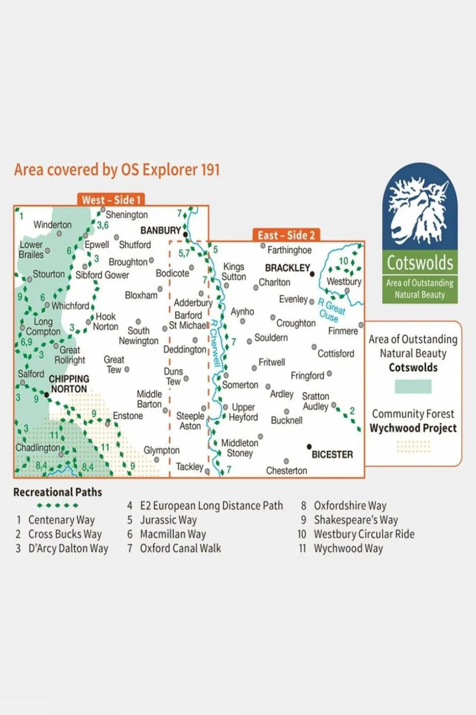

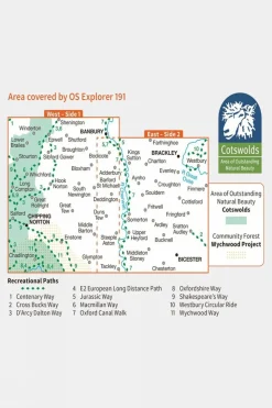
Active Explorer Map 191 Banbury, Bicester and Chipping Norton
Original price was: £16.17.£13.26Current price is: £13.26.
Original price was: £16.17.£13.26Current price is: £13.26.

Duffels+Luggage

Apres

Equipment + Packs

Duffels+Luggage

Equipment + Packs

Duffels+Luggage

Duffels+Luggage

Duffels+Luggage

Duffels+Luggage

Duffels+Luggage

Equipment + Packs

Duffels+Luggage

Equipment + Packs

Duffels+Luggage
Duffels+Luggage

Duffels+Luggage


Reviews
There are no reviews yet.